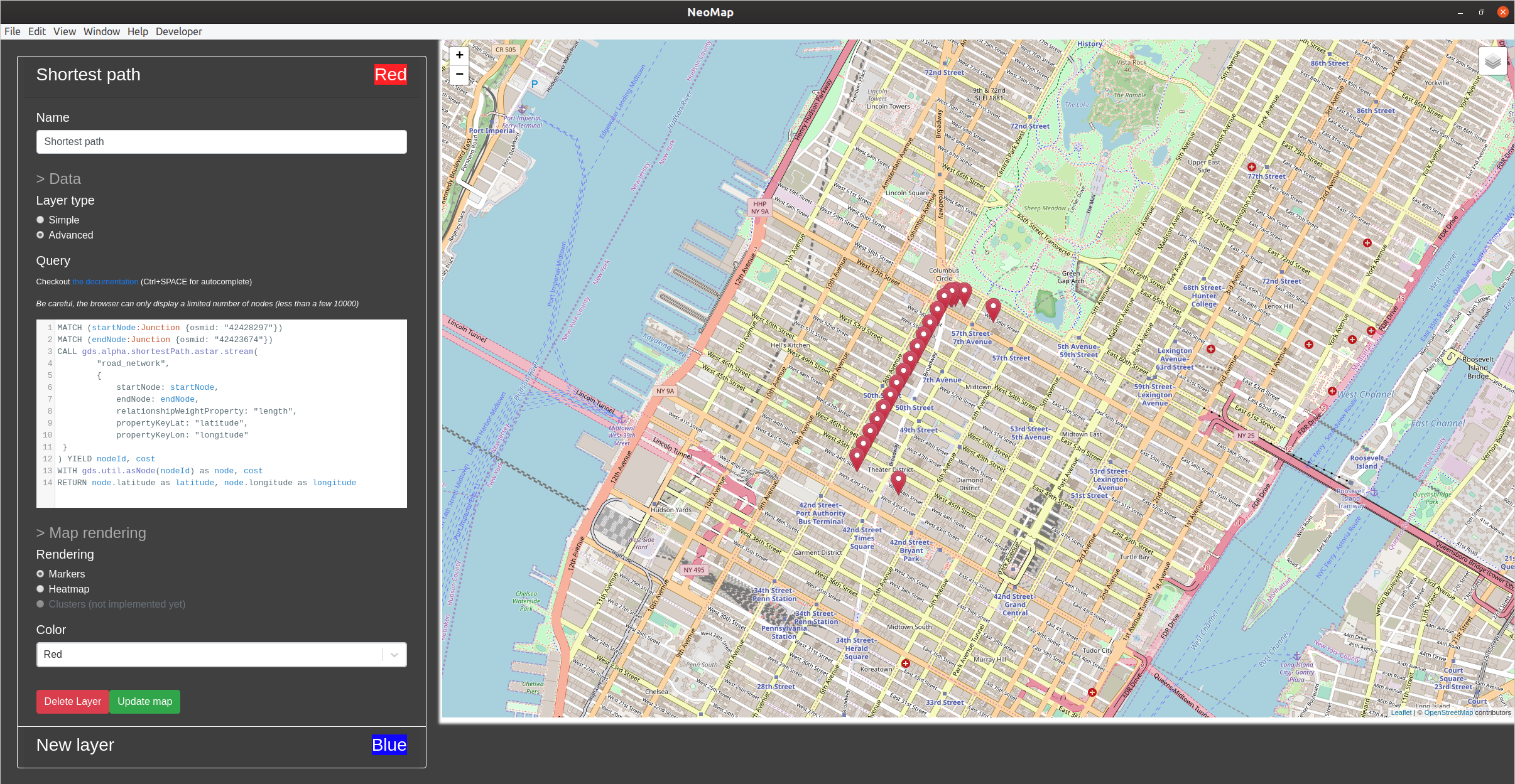
The advanced layer mode allows the user to more precisely select the nodes to be displayed. For instance, we may want to visualize only the nodes involved in the shortest path from Times Square to Central Park South. In that case, we will have to write the Cypher query to match the nodes, and return at least two elements: the latitude and longitude of the nodes.
You can see the configuration used to display the nodes belonging to our shortest path in the following screenshot:
This application helps in visualizing data for data analysis and understanding. However, if we want to visualize spatial attributes in a more interactive way in web applications, we will have to investigate other methods. The following section will demonstrate how to use two JavaScript libraries, the Neo4j JavaSscript driver, and leaflet, to visualize the same path.
In the following section, we will go deeper into the Neo4j JavaScript driver to build stand-alone...