
The spatial data we'll be talking about in this chapter are points on the Earth's surface. There is no unique way to assign coordinates to each point.
Coordinates of a point P on a fixed radius sphere rely on two angles: the longitude, the angle from a reference meridian (θ in the following diagram), and the latitude, the angle with respect to the equator (δ in the following diagram):
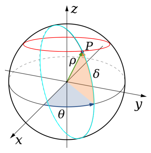
Changing the longitude involves moving in a north-south direction, which corresponds to the y-axis in other projection systems. This means in a general case that longitude is denoted with an x and latitude with a y, which is counter-intuitive.
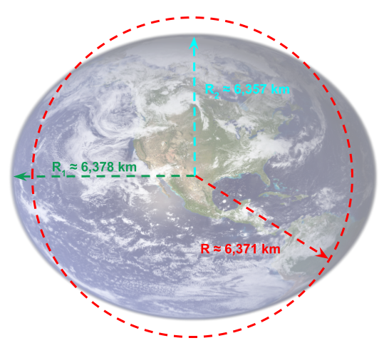
But, as you may know, the Earth is not a perfect sphere. Indeed, the radius close to the equator is higher than the radius at the poles due to centripetal forces, as illustrated in the following image (with exaggerated flatness):
To make things even more complex, the Earth's surface...