Location clustering in geomaps
The initial view of this map, as illustrated in the following screenshot, is crowded with bubbles, and you cannot interpret the results from this view. With the help of location clustering, you can make the map easier to work with.
Execute the following steps to see how location clustering works:
- Select the map, and expand the
Cluster Propertiessection located at the bottom of theBuilderpanel. Note that if you arrive from another story location to this page and click on the map, you see the map layers information on theBuildertab. In the content layers section, click on the Edit icon next toLayer 1to access theCluster Propertiessection:
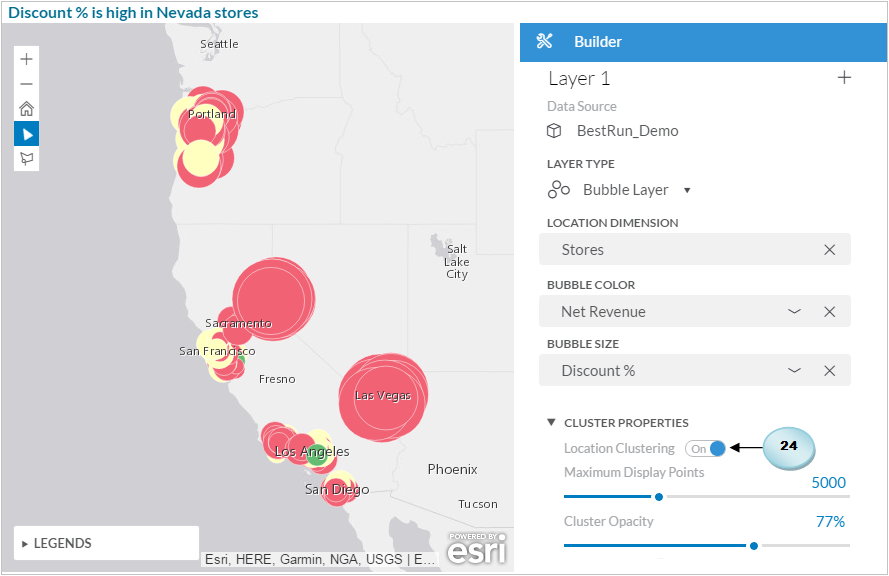
If not turned on, switch
Location Clusteringto theOnposition.Double-click on the existing
Maximum Display Pointsnumber (5,000), and replace it with 10.Set
Cluster Opacityto100%, and, if needed, change the default blue cluster color using the cluster color palette. Click onOKto close this panel.
The map view changes...