Search icon CANCEL
Subscription
0
Cart icon
Your Cart (0 item)
Close icon
You have no products in your basket yet
Save more on your purchases! discount-offer-chevron-icon
Savings automatically calculated. No voucher code required.
Arrow left icon
All Products
Best Sellers
New Releases
Books
Videos
Audiobooks
Learning Hub
Newsletter Hub
Free Learning
Arrow right icon
timer SALE ENDS IN
0 Days
:
00 Hours
:
00 Minutes
:
00 Seconds
Arrow up icon
GO TO TOP
Practical GIS

You're reading from   Practical GIS Learn novice to advanced topics such as QGIS, Spatial data analysis, and more

Arrow left icon
Product type Paperback
Published in Jun 2017
Publisher Packt
ISBN-13 9781787123328
Length 428 pages
Edition 1st Edition
Languages
Tools
Arrow right icon
Toc

Table of Contents (22) Chapters Close

Title Page
Credits
About the Author
About the Reviewer
www.PacktPub.com
Customer Feedback
Dedication
Preface
1. Setting Up Your Environment 2. Accessing GIS Data With QGIS FREE CHAPTER 3. Using Vector Data Effectively 4. Creating Digital Maps 5. Exporting Your Data 6. Feeding a PostGIS Database 7. A PostGIS Overview 8. Spatial Analysis in QGIS 9. Spatial Analysis on Steroids - Using PostGIS 10. A Typical GIS Problem 11. Showcasing Your Data 12. Styling Your Data in GeoServer 13. Creating a Web Map 14. Appendix

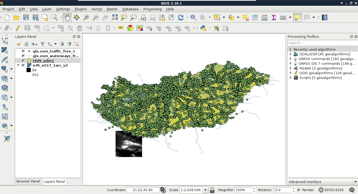
Accessing vector data


Now that you've learned the basics of raster data, let's examine vector data. This is the other fundamental data type which is used in GIS. Let's get some vector data at the top of that srtm layer. From the Browser Panel, we open up the administrative boundaries layer (the one with the shp extension) containing our study area, and the waterways and traffic layers from the OpenStreetMap data. We can also use the Add Vector Layer button from the side toolbar:

Note

If you don't see the points after opening the traffic data, you might have just opened the traffic areas layer. Geofabrik extracts distinguishable areas from lines and points by appending an a to the file name. The traffic_a_free_1.shp file contains polygons related to traffic (for example, parking lots), while the one named traffic_free_1.shp contains points. You can remove obsolete layers by right-clicking them in the Layers Panel and selecting Remove.

Now there are three vector layers with three different icons...

You have been reading a chapter from
Practical GIS
Published in: Jun 2017
Publisher: Packt
ISBN-13: 9781787123328
Register for a free Packt account to unlock a world of extra content!
A free Packt account unlocks extra newsletters, articles, discounted offers, and much more. Start advancing your knowledge today.
Unlock this book and the full library FREE for 7 days
Get unlimited access to 7000+ expert-authored eBooks and videos courses covering every tech area you can think of
Renews at $15.99/month. Cancel anytime
Visually different images