Search icon CANCEL
Subscription
0
Cart icon
Your Cart (0 item)
Close icon
You have no products in your basket yet
Save more on your purchases! discount-offer-chevron-icon
Savings automatically calculated. No voucher code required.
Arrow left icon
All Products
Best Sellers
New Releases
Books
Videos
Audiobooks
Learning Hub
Newsletter Hub
Free Learning
Arrow right icon
timer SALE ENDS IN
0 Days
:
00 Hours
:
00 Minutes
:
00 Seconds
Arrow up icon
GO TO TOP
Geospatial Development By Example with Python

You're reading from   Geospatial Development By Example with Python Build your first interactive map and build location-aware applications using cutting-edge examples in Python

Arrow left icon
Product type Paperback
Published in Jan 2016
Publisher
ISBN-13 9781785282355
Length 340 pages
Edition 1st Edition
Languages
Tools
Arrow right icon
Author (1):
Arrow left icon
Pablo Carreira Pablo Carreira
Author Profile Icon Pablo Carreira
Pablo Carreira
Arrow right icon
View More author details
Toc

Table of Contents (17) Chapters Close

Geospatial Development By Example with Python
Credits
About the Author
About the Reviewers
www.PacktPub.com
Preface
1. Preparing the Work Environment FREE CHAPTER 2. The Geocaching App 3. Combining Multiple Data Sources 4. Improving the App Search Capabilities 5. Making Maps 6. Working with Remote Sensing Images 7. Extract Information from Raster Data 8. Data Miner App 9. Processing Big Images 10. Parallel Processing Index

Working with satellite images


Satellite images are a form of remote sensing data. They are composed of the information collected by satellites and are made available to users as image files. Just like the digital elevation model that we worked on before, these images are made of pixels, each one representing the value of a given attribute for a given geographic extent.

These images can be used to visualize features on Earth using real colors or they can be used to identify a variety of characteristics using parts of the light spectrum invisible to the human eyes.

In order to follow the examples, we will use images from the Landsat 8 satellite. They are available for free on the Internet. Let's take a look at some of the characteristics of this satellite.

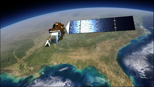
Landsat 8 carries two instruments: the Operational Land Imager (OLI) and the Thermal Infrared Sensor (TIRS).

These sensors can collect data in a total of 10 different bands processed in a resolution of 4096 possible levels (12-bit). The data...

lock icon The rest of the chapter is locked
Register for a free Packt account to unlock a world of extra content!
A free Packt account unlocks extra newsletters, articles, discounted offers, and much more. Start advancing your knowledge today.
Unlock this book and the full library FREE for 7 days
Get unlimited access to 7000+ expert-authored eBooks and videos courses covering every tech area you can think of
Renews at $15.99/month. Cancel anytime
Visually different images