Search icon CANCEL
Subscription
0
Cart icon
Your Cart (0 item)
Close icon
You have no products in your basket yet
Save more on your purchases! discount-offer-chevron-icon
Savings automatically calculated. No voucher code required.
Arrow left icon
All Products
Best Sellers
New Releases
Books
Videos
Audiobooks
Learning Hub
Newsletter Hub
Free Learning
Arrow right icon
timer SALE ENDS IN
0 Days
:
00 Hours
:
00 Minutes
:
00 Seconds
Arrow up icon
GO TO TOP
GeoServer Beginner's Guide

You're reading from   GeoServer Beginner's Guide Share geospatial data using Open Source standards

Arrow left icon
Product type Paperback
Published in Oct 2017
Publisher Packt
ISBN-13 9781788297370
Length 384 pages
Edition 2nd Edition
Arrow right icon
Author (1):
Arrow left icon
 Iacovella Iacovella
Author Profile Icon Iacovella
Iacovella
Arrow right icon
View More author details
Toc

Table of Contents (20) Chapters Close

Title Page
Credits
About the Author
About the Reviewer
www.PacktPub.com
Customer Feedback
Preface
1. GIS Fundamentals FREE CHAPTER 2. Getting Started with GeoServer 3. Exploring the Administrative Interface 4. Adding Your Data 5. Accessing Layers 6. Styling Your Layers 7. Creating Simple Maps 8. Performance and Caching 9. Automating Tasks - GeoServer REST Interface 10. Securing GeoServer Before Production 11. Tuning GeoServer in a Production Environment 12. Going Further - Getting Help and Troubleshooting Index

Tile Caching


Tile Caching is a way to improve the performance of your server. When a layer is configured in the caching system, maps are split into tiles, and then stored in an ordered structure for later retrieval. Therefore, when a new map request hits an area already calculated, GeoServer can retrieve the tiles without having to retrieve data and render them to produce the map. This requires a smaller time than the process of creating a new map, so, caching can boost the performance of your server.

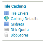
The caching system of GeoServer uses an integrated package--GeoWebCache. It is a Java-based application that complements GeoServer. Consider the following screenshot:

When creating a new layer, you may choose if it has to be cached or not. Let us explore the available options:

  • The Tile Layers section lists all cached layers and lets you review and modify parameters. It also contains a link to a layer preview very similar to that listed in the Data section. The main difference is that this preview...
lock icon The rest of the chapter is locked
Register for a free Packt account to unlock a world of extra content!
A free Packt account unlocks extra newsletters, articles, discounted offers, and much more. Start advancing your knowledge today.
Unlock this book and the full library FREE for 7 days
Get unlimited access to 7000+ expert-authored eBooks and videos courses covering every tech area you can think of
Renews at $15.99/month. Cancel anytime
Visually different images